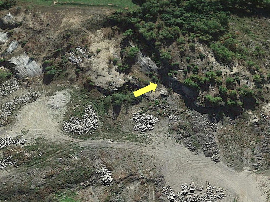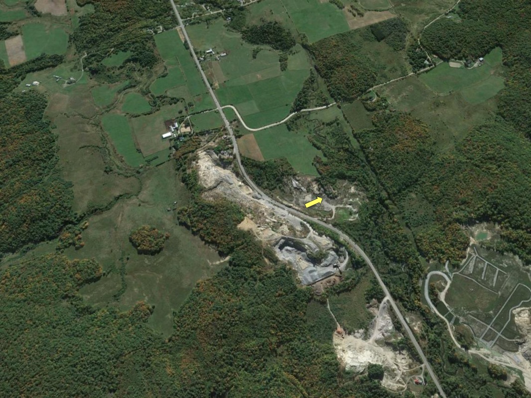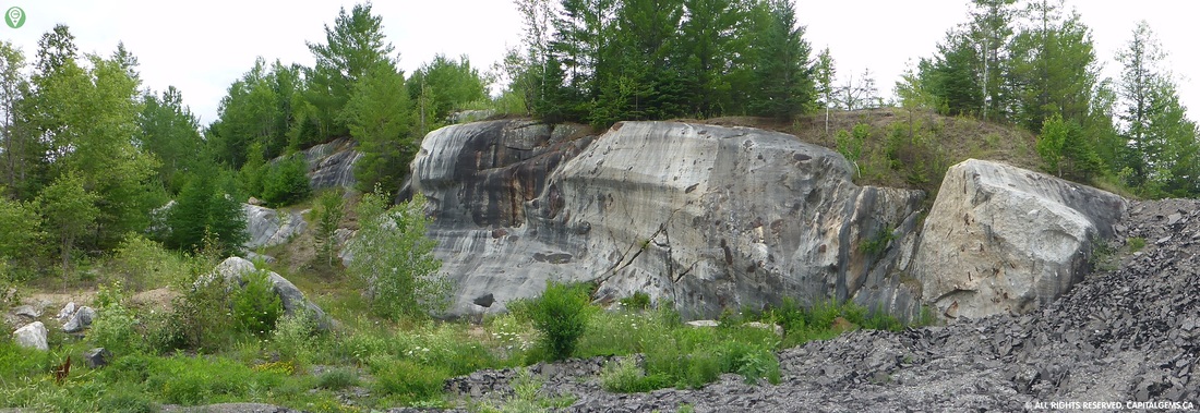
We drove by this location in the past and was looking for information behind its creation. The marble rock formation is smooth and at some spots reaches the height of 20 feet. The smooth marble rock was located underground until the City of Cantley approved the creation of a Quarry. Upon digging they discovered this historical rock formation.
The following historical information was written and provided by Ottawa Gatineau Geo Heritage. "This site is an excellent spot for contemplating relative geological history and the challenges geologists face in the field when trying to piece together what has happened to create this particular configuration of rock. The outcrop consists of Precambrian Grenville marble, in places topped by Holocene glacial sediments. There is a difference of almost 1 billion years between the marble and the sediments on top; this is called an unconformity - we have no record of the intervening time. The outcrop itself shows both brittle and ductile deformation; the marble would have originally been layers of limestone which behaved in a plastic way when confronted with metamorphic forces of heat and pressure, flowing around what were once more brittle silica-rich layers of shale or igneous intrusions. These more brittle rocks would have broken with the stress, and been moved and incorporated within the more ductile rock to produce the features we see now. The unusual sculptured shape of the outcrop is the result of hydraulic scouring by debris carried in subglacial meltwater moving under high pressure.The rock surfaces also show glacial striae (parallel linear scratches)." Location ID #LS0021
|
|