CapitalGems.ca
  • Home
  • Buildings and Ruins
  • Caves and Mines
  • Landscapes
  • Other
  • About Us
  • Contact

South Marsh Highlands Homestead Ruin

KANATA, ONTARIO
BACK

Picture

INFORMATION

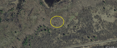
This Homestead ruin is located in the South March Highlands Conservation Forest. The exact history of this ruin is unknown. If anyone knows any historical information regarding this ruin, please let us know.

​According to online research the ruin belongs to an old homestead that predates the 1900’s. Other ruins from the 1800’s are located in the surrounding area. This ruin remains intact due to the ongoing conservation efforts. We were surprised at the great condition of the stone foundation and at the number of artifacts left in the area by the original inhabitants.

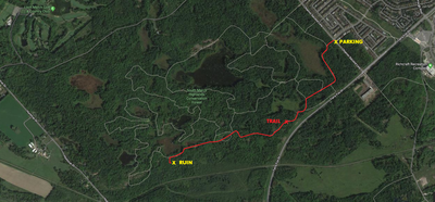
The walk from Second Line road “Parking Lot” to the ruins is 3 kilometers one-way adding to a total hike of 6 kilometers. The terrain begins flat then becomes very hilly. The homestead ruin is worth the hike.
Note: Stay on the trail as much as possible as we had multiple ticks attached to our clothing.
​
Accessing this site from Huntmar Dr. via the railroad is shorter but will leave you walking through a swampy area and through extremely dense forest. We recommend parking on Second Line Rd. 

Location ID #BR0085

Picture
POTENTIAL RISKS:
No Restrictions

Tick Prone Area
Thorn Bushes
​Swampy 

Picture
TERRAIN DIFFICULTY:
Picture

Picture
FAMILY FRIENDLY:
​
Yes

Picture
EQUIPMENT:
Hiking Shoes
​Bug Spray

Picture
TOURS:
N/A

Picture

MAPS:


Picture

 photography​


Picture

How To Get There:

- Park your vehicle on Second Line Road. Head towards the “Fast Out” trail.
- Hike the “Fast Out” trail until you reach the end of the trail.
- Turn left on “Dog Sled” trail and hike until you reach the end of the trail.
- “Dog Sled” trail will become “Ridge Top” trail.
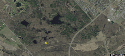
- Continue down “Ridge Top” trail until you reach an unofficial trail near the coordinates provided below on your left that goes slightly downhill. Take this trail until you are parallel to the coordinates provided below.
- Hike through the forest for about 30 meters until you reach the ruin.

Picture
Coordinates: 45.332376, -75.962161
DOWNLOAD COORDINATES

Picture
Estimated Travel Time: 00:22:00 from downtown Ottawa.


FOLLOW US ONLINE

Use the search bar above to search any topics/locations on CapitalGems.ca
Last Updated: April 15, 2021
Thank You For Your Ongoing Support
Copyright © 2013 - 2021 Capital Gems, All rights Reserved

Privacy Policy
Liability
Copyright
Donate
Career
Contact
Submit Location

  • Home
  • Buildings and Ruins
  • Caves and Mines
  • Landscapes
  • Other
  • About Us
  • Contact