|
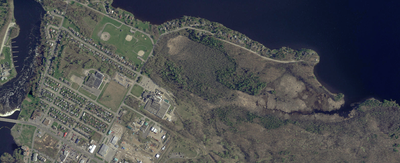
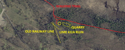
The Arnprior Lime kiln Ruins are easy to access and a great place to visit. Located on the Macnamara Nature Trail, the ruins of this old kiln and quarry are still visible.
The following historical information was provided by mfnc.ca. There are a number of metamorphic rock types, but here on Macnamara Nature Trail many of the exposed outcrops are marble. Marble is metamorphosed limestone, a relatively soft rock, high in calcium content. Not only is limestone readily modified by chisel, it is also easily transformed by fire. In front of you lies an old lime kiln in which either limestone or marble was burned to produce lime. Inside this igloo-like structure large piles of wood were stacked up. On top of this were dumped loads of calcium-rich rock broken into small chunks by sledgehammers. The wood was set on fire, and after days of burning (additional fuel was probably added through the little doorway at the front of the kiln) the charred rock was removed. When water was added to the burnt rock, it produced a product known as “slaked lime.” This product could be used as cement or paint. This lime kiln was built by the McLachlin Lumber Company sometime in the mid-to-late 1800s. The burnt rock was taken away by horse and cart, and buried in the ground near the company’s lumbering operations along the Ottawa and Madawaska rivers. Whenever slaked lime was needed, the stockpile was dug up. Water was added to the burnt rock, as well as another agent known as “Recketts Blue.” Barrels and buildings were painted with the resulting paint, known as whitewash, which acted as an antibacterial agent as well as a beautifying coat. Slaked lime was also used as mortar in foundations and brickwork. The McLachlin Lumber Company shut down in the mid-1930s, but the activity at this lime kiln likely came to an end well before that time. As you leave this platform and walk back to the main trail, look to your right. Many of the rocks bear irregular and sharp edges, suggesting that dynamite was used to initially break the outcrop into workable pieces. Thus, Nopiming marble rather than sedimentary limestone may have been burned in this kiln. mfnc.ca We’d like to thank Mike Cho-Chu for submitting this location to us and for his ongoing contribution. Location ID #BR0087 |
|


