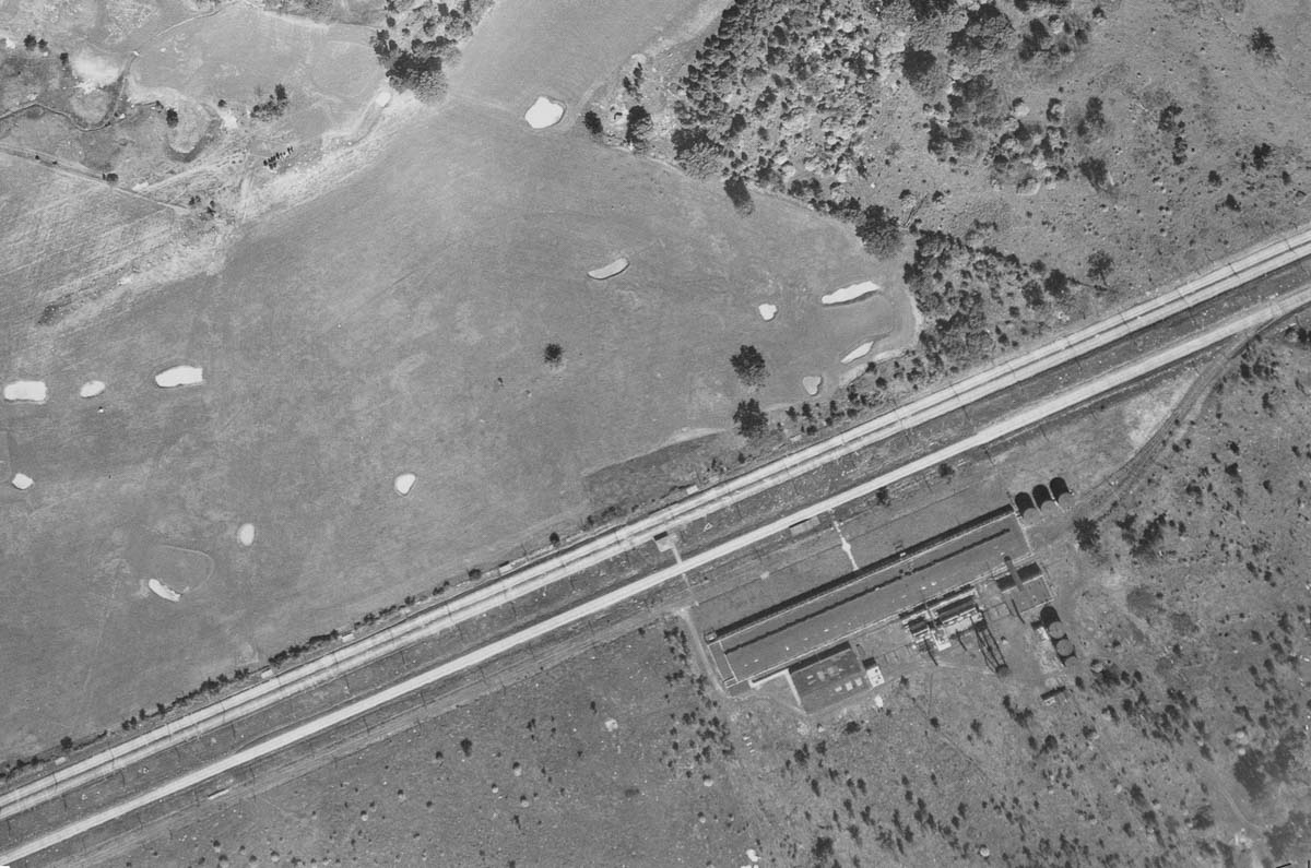
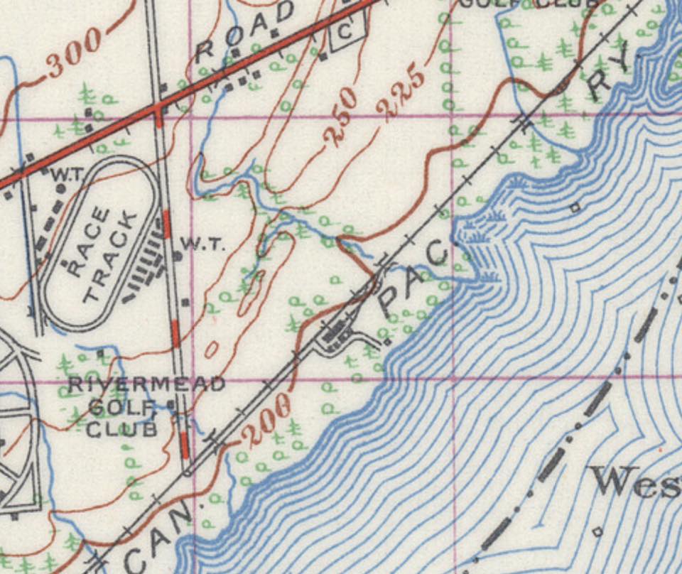
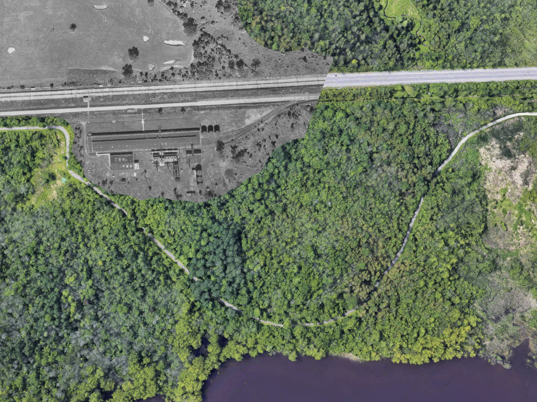
The Old Beaver Company plant located near Lucerne rd. was built in the 1920s to 1930s. The NCC bike trail "Sentier Des Voyageurs" takes a hard 90 degree angle towards the river as the ruins are in the way. All that remains of the plant are foundations and a series of old concrete underground storage containers. If you plan on visiting, please watch your step and be prepared to walk through extremely dense vegetation.
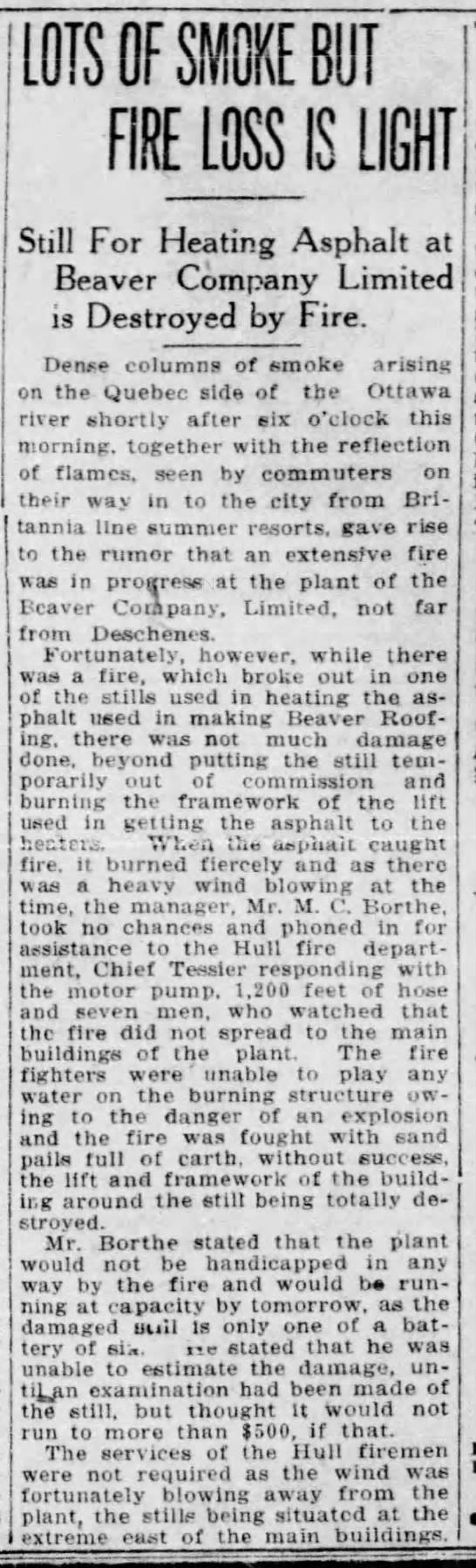
How do we know these ruins belong to the Beaver Company ? 1. There is a record of “Beaver Company” having a spur on the CPR Waltham Sub at M3.303. 2. An article was found from July 19, 1922 in the Ottawa Citizen about a fire at the Beaver Company plant in Québec. It appears this was related to asphalt or roofing. A look at later aerials seem to show the buildings were demolished sometime before 1945. There is a water tower and what appear to be gas storage tanks, but trains use coal, and trams electricity. And the site is 'neat' not like there is manufacturing occurring. This confirms that the siding was made for the Beaver Company and this is where Vulcanite roofing was made. The Beaver asphalt roofing plant seems about right for the timing of the wind-down. Up to mid-1927, "Vulcanite Roofing" was advertised as a patented product of the Beaver Company, based in Thorold, Ontario. Beginning in the fall of 1927, however, Vulcanite Roofing began to be advertised as a product of the Vulcanite Division of Building Products Ltd., with mills in Hamilton and Montreal, while the Beaver Company continued to advertise its premier product, Beaver Board. It looks like Beaver sold off its roofing product to BPL, which may have gradually wound down the Deschenes plant, ultimately transferring all production to its main sites. Location ID #BR0111
|
Historical Photographs
|