CapitalGems.ca
  • Home
  • Buildings and Ruins
  • Caves and Mines
  • Landscapes
  • Other
  • About Us
  • Contact

LitchfiEld Lake
​Fire Tower Ruins

LITCHFIELD, ​QUÉBEC
BACK

Picture

INFORMATION

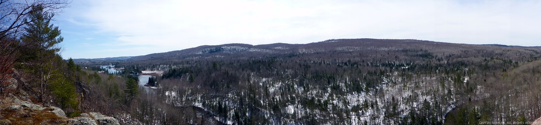
Near Litchfield Lake in the Bell Mount area at the top of a mountain lay ruins of an old fire tower foundation. The fire tower was used to detect fires in an area covering 100+ square miles of land. From this location you can see for miles making it a beautiful place for photographs. We looked down at the roaring spring river as an eagle flies above us. The fire tower foundation is made of six concrete blocks as well as holes that would have supported large wooden beams; suggesting a building or shack was built below the fire tower. The access road to the fire tower ruins is only accessible on foot.

Location ID #BR0037

Picture
POTENTIAL RISKS:
No Restrictions
Cliff

Picture
TERRAIN DIFFICULTY:
Picture

Picture
FAMILY FRIENDLY:
Yes

Picture
EQUIPMENT:
None Needed

Picture
TOURS:
N/A


Picture

How To Get There:

Park your car at the end of Chemin Barette and then follow coordinates below.

Picture
Coordinates: 45.833033, -76.576285       
DOWNLOAD COORDINATES

Picture
Estimated Travel Time: 01:40:00 from downtown Ottawa.


FOLLOW US ONLINE

Use the search bar above to search any topics/locations on CapitalGems.ca
Last Updated:  October 18, 2021
Thank You For Your Ongoing Support
Copyright © 2013 - 2021 Capital Gems, All rights Reserved

Privacy Policy
Liability
Copyright
Donate
Career
Contact
Submit Location

  • Home
  • Buildings and Ruins
  • Caves and Mines
  • Landscapes
  • Other
  • About Us
  • Contact